You load up your favorite sim, pick a track you've driven in real life, and within two corners something feels off. The braking zone doesn't match what you remember. The elevation change mid corner isn't there. The curbing on exit is in the wrong spot. You chalk it up to the sim being "close enough" and keep driving.
But here's the thing: some tracks in your sim are accurate down to the millimeter. Others are educated guesses shaped by satellite photos and YouTube onboards. The difference between the two comes down to one thing.
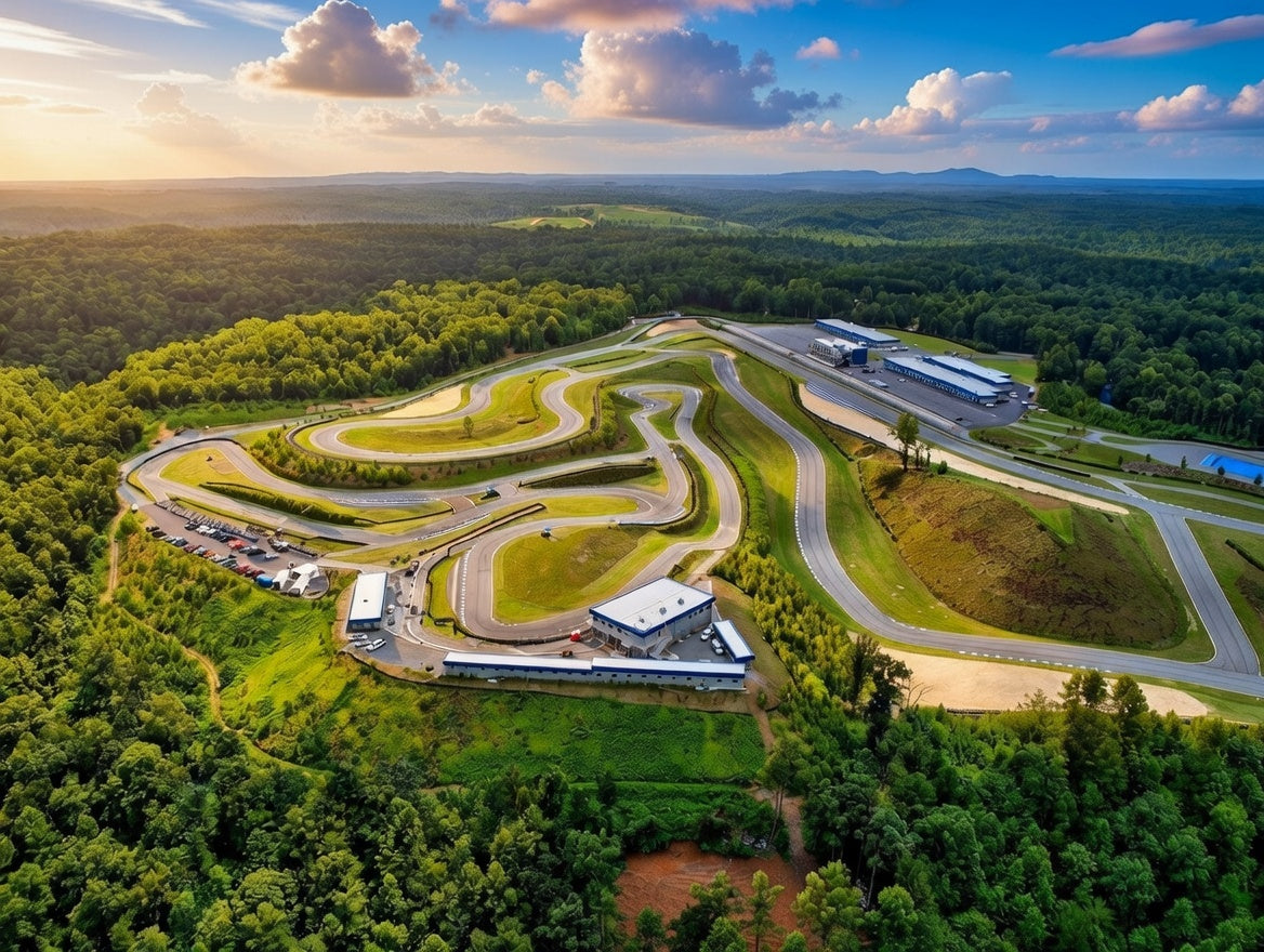
Whether or not the track was LiDAR scanned.
What LiDAR Actually Is
LiDAR stands for Light Detection and Ranging. In simple terms, it's a technology that fires thousands of laser pulses per second at a surface and measures how long each pulse takes to bounce back. The result is a point cloud, a three dimensional map made of millions of individual data points that captures the exact geometry of whatever was scanned.
When applied to a racetrack, LiDAR captures everything. The width of the racing surface. The exact camber angle in every corner. Elevation changes down to millimeters. The precise location and height of every curb. The runoff areas. The walls. The bumps. The cracks. The patches. Every physical detail that exists on the real track gets recorded as data.
That data becomes the foundation for a digital version of the track that doesn't approximate reality. It replicates it.
Why It Matters for Sim Racing
The entire value proposition of a racing simulator rests on fidelity. The closer the virtual environment matches the real world, the more useful it is for training, for competition, and for pure driving enjoyment.
A track built without LiDAR data relies on other sources: satellite imagery, GPS traces from real laps, photographs, and the interpretation of whoever modeled it. These methods can produce tracks that look correct from overhead and feel approximately right at speed. But "approximately right" breaks down fast when you're trying to use a simulator for anything beyond casual entertainment.
Here's where the differences show up:
Elevation. This is the single biggest gap between scanned and unscanned tracks. Satellite imagery is essentially flat. It can show you where the track goes, but it cannot tell you that the braking zone into Turn 3 drops two meters over 50 meters of distance. LiDAR captures that drop precisely. When you brake in the sim on a scanned track, the car behaves the way it would on the real surface because the surface geometry is correct. On an unscanned track, that braking zone might be modeled as flat, which means your braking reference from the sim won't match reality.
Camber and banking. Corners aren't just curves. They tilt. Some bank positively, pushing the car down into the surface and adding grip. Some fall away negatively, reducing grip and making the car feel loose. The degree of banking changes how much speed you can carry, where the car rotates, and how the tires load up. LiDAR measures camber angles precisely. Without it, the track modeler is guessing, and even a one or two degree error in camber can fundamentally change how a corner drives.
Surface detail. Real tracks are not smooth. They have bumps from settling pavement, seams where old surfaces meet new ones, patches over repaired sections, and undulations that develop over decades of use. These surface details affect car behavior in measurable ways. A bump at the apex of a high speed corner can unsettle the car and require a specific driving approach. LiDAR captures these details. A hand built track model typically smooths them out because the modeler simply doesn't have the data to include them.
Curbing geometry. Curbs are not decorative. They're functional elements that drivers use deliberately. The height, angle, and spacing of curb teeth determine whether you can ride them aggressively or need to avoid them. LiDAR scans capture the exact profile of every curb on the circuit. On an unscanned track, curbs are often modeled as generic raised surfaces that don't match the behavior of the real ones.
Track width and positioning. Even something as basic as how wide the track is and exactly where the edges fall can be off on unscanned tracks. LiDAR provides precise measurements of the racing surface, the margins, and the transition zones between track and runoff. This matters for practicing lines that use every centimeter of available road.
How the Major Sim Platforms Handle Track Accuracy
Not all sims approach track creation the same way, and the level of accuracy you get varies significantly depending on the platform and the specific track.
iRacing is widely regarded as the gold standard for track accuracy in sim racing. The vast majority of their track catalog is laser scanned, and iRacing has invested heavily in scanning operations over the years. When you drive a scanned iRacing track, the surface geometry is derived directly from real world LiDAR data. Elevation, camber, bumps, curbing, and surface transitions are all based on measured reality. This is a major reason why professional racing teams, driving coaches, and serious competitors gravitate toward iRacing for track preparation.
Assetto Corsa and Assetto Corsa Competizione feature a mix of scanned and unscanned content. Several tracks in their official libraries are laser scanned, but the modding community for Assetto Corsa is enormous, and the accuracy of community created tracks varies wildly. Some modders have access to scan data and produce highly accurate circuits. Others work from reference photos and GPS traces, producing tracks that look right but may not drive accurately at the limit.
rFactor 2 supports LiDAR scanned content and has several officially scanned tracks in its library. The platform's physics engine is highly regarded among professional teams, and when paired with accurate track data, it's a powerful simulation tool.
The takeaway is that not every track on your favorite platform is created equal. A scanned version of Spa Francorchamps and an artist built version of Spa Francorchamps might look similar in screenshots, but they will drive very differently in the corners that matter most.
How a LiDAR Track Scan Actually Works
The process of scanning a racetrack is more involved than most people realize.
A scanning team arrives at the facility with ground based LiDAR units, high precision GPS equipment, and increasingly, drone mounted LiDAR systems. The ground based scanners are positioned at multiple locations around the circuit, each one capturing a 360 degree point cloud of its surroundings. These individual scans are then registered (aligned) together using common reference points to create a single, continuous 3D model of the entire facility.
The raw output is a massive point cloud, sometimes containing billions of individual points. That data is then processed, cleaned, and converted into a usable mesh that sim developers can import into their track building pipeline. Textures, 3D objects (buildings, trees, barriers), and surface materials are added on top of the geometric foundation.
The geometry, the part that determines how the track actually drives, comes from the scan. Everything else is visual polish.
What You Lose Without a Scan
Here's a practical example. Imagine you're preparing for a race at a track you've never visited. You load it up in your sim and spend 50 laps learning braking points, lines, and corner speeds. You arrive at the real track feeling prepared.
If the sim version was LiDAR scanned, your braking references will be close. The elevation changes will feel familiar. The corners will load the car the way you expected. You'll spend your first real session refining, not relearning.
If the sim version was hand built without scan data, some of your references will be wrong. A braking zone you practiced as flat might actually go downhill, extending your stopping distance. A corner you carried speed through confidently in the sim might have negative camber in reality that reduces grip. You'll spend your first real session unlearning what the sim taught you and starting over.
For casual enjoyment, this difference might not matter. For anyone using a simulator as a training tool, it's the difference between preparation and false confidence.
The Accuracy Gap Is Closing
The good news is that LiDAR technology is becoming more accessible and more affordable. Drone based scanning systems have dramatically reduced the time and cost required to capture a full circuit. What once required a multi day operation with heavy ground equipment can now be supplemented or even led by aerial platforms that cover the same area in a fraction of the time.
This means more tracks are getting scanned. More data is becoming available. And the overall quality of sim racing environments is climbing steadily.
It also means that track operators who haven't had their facilities scanned are increasingly at a competitive disadvantage. Drivers choosing where to spend their time and money want to practice on tracks they can also prepare for in the sim. A facility with accurate sim representation becomes more attractive to the very customers who are most engaged and most likely to return.
How to Tell If Your Track Is Scanned
Most sim platforms indicate whether a track is laser scanned in the track description or metadata. In iRacing, scanned tracks are explicitly labeled. In Assetto Corsa, you may need to check the source of the mod or content pack.
If you're unsure, there are a few telltale signs:
Drive a track you know well in real life. If the elevation changes, camber angles, and surface bumps match your real world experience closely, it's almost certainly scanned. If the layout is right but the surface feels generic or flat in places where you know there are features, it probably isn't.
Check for surface imperfections. Scanned tracks have bumps, patches, and irregularities because the real track has them. A perfectly smooth surface is a sign of artist modeling, not measured data.
Look at the curbs closely. Scanned curbs have specific geometries, varying heights, angles, and spacing. Generic curbs that all look the same across the entire circuit suggest the track was built without precise scan data.
The Bottom Line
Not every sim track is created with the same level of accuracy, and that accuracy directly affects how useful the simulator is for anything beyond casual play. LiDAR scanned tracks replicate the real world with a precision that no other method can match. If you're using a simulator for track preparation, driver development, or serious competition, knowing whether the track you're practicing on is scanned isn't a minor detail. It's the foundation that everything else is built on.
The closer your virtual track matches reality, the more your virtual laps count when it matters.
RRG Racing understands track accuracy from both sides, as simulator builders and as operators based at a real motorsports facility. Our sister company Lunis specializes in LiDAR scanning and racing data technology, bridging the gap between real world surfaces and the simulators we build. Visit rrgracing.com to learn more.
Share:
Why Track Operators Should Consider Getting Their Facility Scanned
The Rise of Corporate Sim Racing Events and Team Building